")


")


Table of Contents
- What Is a Land Survey?
- Key Components of a Land Survey
- Understanding Bearings and Distances
- Recognizing Survey Markers and Monuments
- Importance of Accurate Land Measurements
- Common Mistakes in Land Measurements
- How to Read a Land Survey
- Conclusion
For property owners, homebuyers, and developers alike, understanding land surveys is a vital step in any real estate transaction. Land surveys define property boundaries and reveal important site features, helping ensure clarity, prevent disputes, and pave the way for smooth property transfers or construction projects. Early in your research, use a property lines map to visualize lots, boundaries, and features. These tools couple geographic information with official record data, making the initial survey process easier than ever.
Accurately assessed land boundaries are not just legal requirements—they’re essential tools for resolving disagreements, unlocking property potential, and keeping projects on track. Misunderstanding a property line or structure’s placement can lead to costly mistakes, so it’s important to be proactive and knowledgeable about the details that make up a land survey.
Land survey documents offer a wealth of information, from topography to legal descriptions. The key is learning to interpret their various sections and symbols. Knowing how to read the bearings, markers, and technical terms gives you a significant advantage whether you’re buying, building, or defending property rights. This guide outlines the core elements and practical steps to help you approach land surveys with confidence.
Land measurement mistakes can impact everything from fence lines to zoning compliance. Becoming familiar with boundary elements, legal descriptions, and how surveyors use on-the-ground markers will help you avoid these common pitfalls. By learning these concepts, you’ll ensure that your property experience is based on accurate, reliable land survey and measurements.
What Is a Land Survey?
A land survey is a certified, detailed map of a property showing its boundaries, topography, and any notable features. Licensed surveyors conduct these measurements using specialized equipment and official records to create documents that hold legal weight for real estate deals, development projects, or boundary disputes. Having an accurate land survey ensures there’s no confusion over where your property begins and ends, which can help avoid years of disagreement and litigation.
Key Components of a Land Survey
-
Title Block:
Lists crucial details such as the surveyor’s name, project date, and specific job information.
-
Legend:
Explains the symbols, lines, and abbreviations used throughout the survey diagram.
-
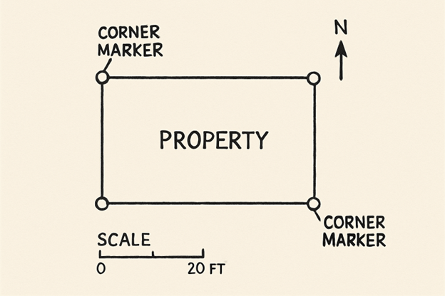
Scale and North Arrow:
Indicates the drawing’s scale and orientation, helping users relate the map to real-world coordinates.
-
Legal Description:
Provides precise text-based definitions of the surveyed property, usually referencing official records and local landmarks.
-
Boundary Lines:
Clearly outlined using bearings and distances, these lines delineate the perimeter of your land.
-
Easements and Right-of-Ways:
Denotes regions where other entities—such as utility companies or municipalities—have certain legal rights to access or cross your land.
-
Structures and Improvements:
Marks any buildings, fences, roads, driveways, or other modifications that can affect value or development plans.
Understanding Bearings and Distances
Bearings and distances form the backbone of any property description. Bearings specify direction using degrees, minutes, and seconds (such as N45°30’00″E), while distances record the exact length between boundary markers, often measured in feet or meters. By reading these, you can trace each side of your property and check for consistency with legal records or physical markers on the ground.
Recognizing Survey Markers and Monuments
Professional surveys rely on visible markers or monuments placed at property corners and along boundaries. Iron rods, pipes, wooden stakes, or concrete monuments are common. These help current and future property owners, as well as officials, physically identify the exact locations detailed in survey documents. Knowing what each marker means and how to find them on your own land can clarify uncertain boundary lines.
Importance of Accurate Land Measurements
Land measurement errors can have serious financial and legal consequences. A small miscalculation may trigger a boundary dispute, delay construction, or jeopardize a sale. Precision is vital: government regulations, local zoning laws, and lending requirements all depend on accurate property details. That’s why working with a reputable, licensed surveyor is crucial for smooth transactions and lasting peace of mind.
Common Mistakes in Land Measurements
Ignoring or misreading legal descriptions, skipping certain markers, or failing to address elevation changes are all common errors. Over time, reference points can move, markers may be buried or destroyed, and deed descriptions may no longer reflect current site conditions. It’s essential to compare your land survey and measurement with up-to-date municipal plat maps and consult experts if you identify discrepancies before making any decisions.
How to Read a Land Survey
1. Identify the Survey Purpose:
Whether you’re planning a sale, construction project, or property improvement, knowing the purpose helps shape which features and details to prioritize.
2. Review Key Sections:
Pay close attention to the title block, legend, scale, legal description, and boundary lines for immediate orientation.
3. Interpret Bearings and Distances:
Trace property lines using bearings and distances, checking against on-the-ground markers and legal descriptions.
4. Locate Physical Markers and Structures:
Use the map to find iron pins, stakes, corners, and any listed structures or improvements.
5. Evaluate Topography and Elevation (If Included):
Topographic lines and annotations provide valuable information for building project planning, particularly on sloped or irregular sites.
6. Cross-Reference with Official Records:
Always compare your survey information with deeds, local plats, or tax records to confirm accuracy and ensure compliance.
Conclusion
Land surveys and precise measurements serve as the foundation for secure ownership, informed decision-making, and successful property development. Learning to interpret a study equips you to safeguard your investment, avoid disputes, and act confidently as a property stakeholder. With attention to detail, a willingness to seek professional guidance, and the right resources, you’ll ensure that your property experience is based on clarity and certainty.
Find a Home-Based Business to Start-Up >>> Hundreds of Business Listings.